May 2015
Oilfield Technology
|
19
geopolitics, technology, safety and
environmental concerns.
Drowning in information
Geoscientists today have over 200
years of accumulated data available
to help them make better decisions.
Universities, governments and industries
have their research departments and
consortia. Professional societies hold
conferences and publish valuable papers
and books. The Geological Society of
London has been sharing data among its
members since 1807 and the Geological
Society of America since 1888. The
Journal of Sedimentary Research has
been published since 1931. All of these
resources contain a wealth of information
that is often taken for granted because it
is scattered, and unstructured, making
it more difficult to integrate into the
geoscientist’s workflow. In addition
to published content, there is also a
tremendous amount of commercial
data that has been gathered from direct
acquisition via seismic surveys and
well drilling both by private and public
entities (e.g., DSDP).
One advantage that geoscience has
over other scientific disciplines is that
its information rarely goes out of date.
Although the techniques of gathering
and analysing data continue to advance,
a stratigraphic column published fifty
years ago may still contain some valuable
information. So, rather than spending
US$ 2 million to US$ 200 million to
conduct a seismic survey or US$ 5000/m
on well data, exploration companies
can use existing published data to gain
valuable insights to the subsurface
geology, eliminating the high risk areas,
narrowing the area of interest and
identifying the most promising areas to
target for data acquisition.
It used to be that geoscientists would
have to locate, access and pore over
piles of physical maps, scientific papers
and reports to extract the bits they
needed. Even today, it is common to hear
geoscientists complain that they ‘don’t
know what they don’t know.’ Now, two
centuries of data is readily available in
digital formats. This is a vast improvement
– the data can be easily accessed, stored
and retrieved – but tremendous time and
effort is still needed to locate which of the
hundreds of thousands of digitised maps,
articles and papers contain the data
needed to evaluate a particular site.
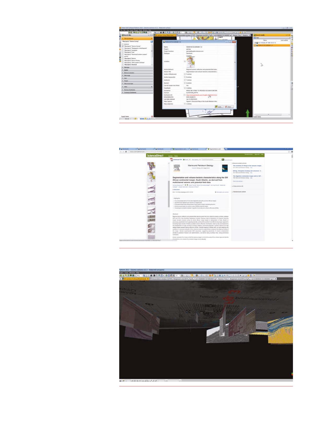
Figure 4.
Users can viewmapmetadata (i.e., bibliographic information for the source article,
associatedgeologic basins, map scale, etc.) and can seamlessly loadgeoreferencedmaps and
associateddata intoPetrel projects.
Figure 5.
Access back to the scientific literature provides greater knowledge and insight aswell as
access to all associateddata.
Figure 6.
Integration of content fromGeofacets enables the user to build 3-Dmodels of the
subsurface geology, helping to identify lateral continuity of the reservoir and seal (light green line
in smaller profile inset).


