May
2015
Oilfield Technology
|
15
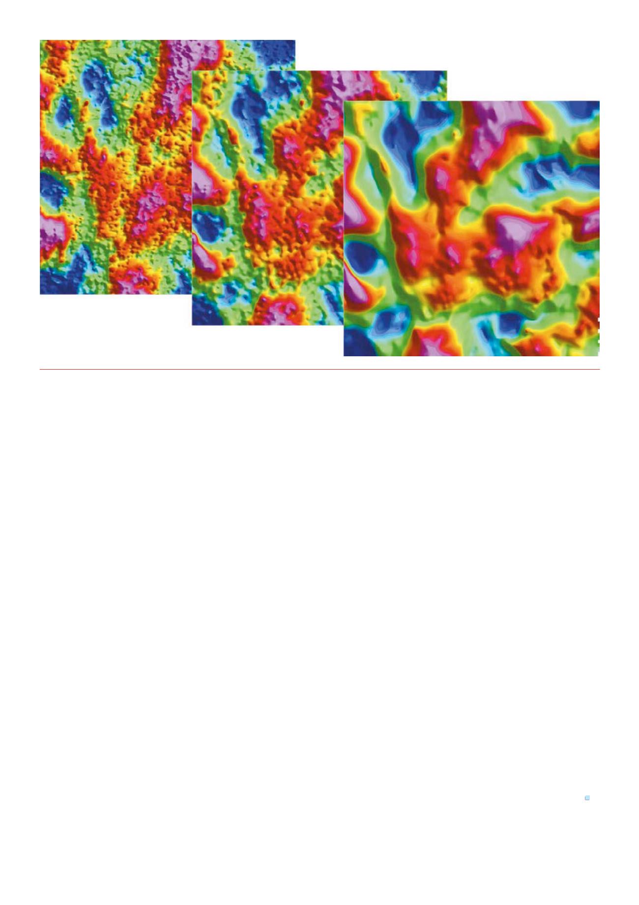
Figure 3.
Proprietary processing toolsmaximisingdataquality.
Bell Geospace operates Basler Turbo aircraft with the
Lockheed Martin FTG system, and with this configuration
they routinely capture 1600 line km of high quality data in a
single working day; made possible because the aircraft are
equipped with long-range fuel tanks allowing them to stay
airborne for eight hours or more. Interim images of the data
are made available to clients within 24 hrs of acquisition,
allowing flexibility to modify or expand the initial acquisition
plan. CEPSA, Petronas, Repsol, Tullow and many more have
all benefitted from this, allowing key management decisions
to be made on 2D and 3D seismic planning. Final results can
be made available within 4 - 6 weeks, dramatically reducing
time waiting for decisions over more complex exploration
techniques.
FTG fits into the work flow pre- or post- seismic. Prior
to 2D seismic FTG can be used to identify promising targets
and design a focussed plan for a more cost-effective seismic
programme. If 2D seismic has already been shot, the planning
phase can be adapted to ensure that the survey and final data
set fully incorporate the known geology and existing data to
provide the most complete picture possible, drastically cutting
future spend on expensive 3D seismic or drilling programmes.
So, the opportunities for FTG to be used to reduce costs
are enormous. Simply put, and to quote Tullow Oil’s Annual
Report, sparse 2D seismic combined with FTG will provide 90%
of the value of a full 3D seismic survey for 5% of the cost. For
this reason alone, FTG is clearly a valuable tool, particularly in
a challenging economic environment.
It is obvious that acquiring seismic is not a passive activity.
It can – and does – have quite an impact, however careful
operators are, and there are parts of the world where it is
simply not possible to acquire seismic data. For example,
it can be very difficult would it be to acquire good quality
seismic data over transition zones of ice, rock and water.
Because FTG data is (usually) acquired from the air it can be
acquired in many of these situations where seismic is not
financially viable. The Basler aircraft are able to fly challenging
terrain and the operator is able to acquire data without the
use of tielines, allowing a lower flying height and thereby
dramatically increasing the data quality and diversity of
terrain, which can be flown safely. Essentially, aerial FTG
surveys can be conducted just about anywhere - onshore,
offshore, jungle, desert or Arctic; it has even been flown over
densely populated cities (working closely with Los Angeles Air
Traffic Control, the company has recently completed a survey
that would be impossible to do using traditional seismic
technology, flying their survey’s pre-programmed flight lines
between 11pm and 6am to avoid busy airspace during the day).
Using this technology, the operator will leave no footprint
on the survey area. The Basler aircraft even have upward facing
engine exhausts to minimise the aircraft’s noise on the ground
below. The non-invasive nature of FTG surveys is a clear benefit
in environmentally sensitive areas like the Arctic or in the
presence of wildlife, like migrating puffins or mating reindeer,
but it also has other interesting advantages, for example, in
areas of political instability.
Drastic times call for drastic measures. Operators are
traditionally drawn to seismic acquisition as a proven
technology, but in these days of cost-cutting, new ways have
to be found to maximise the exploration potential, whilst
minimising the effect on the bottom line. These lean times
need to be used to look more closely at how innovation –
whether brand new or, in the case of FTG, established – can
complement traditional techniques and maintain a global
exploration programme that promises a sustainable future.
Reference
1.
.


