18 |
Oilfield Technology
May 2015
Today, oil and gas exploration
is a higher risk business, but the
benefits and potential returns are
also greater. Operating an offshore
rig costs millions of dollars per day,
but the potential returns are in
the billions. A wealth of scientific
data has accumulated over the
century and a half since the
Titusville boom, making it easier
for companies to assess oil and
gas reservoirs, yet oil companies
are spending more on exploration
and finding less. Therefore, one
of the problems that exploration
companies face is how to reduce
both the risk of failure and their
costs at the same time.
Scientificadvances
Since the advent of the automobile
age, tremendous advances have
been seen in the geophysical
sciences that help geoscientists
identify areas of high and low risk
before the first exploration well
is drilled. Seismic, satellite and
magnetic imaging technologies
feed raw data into 3D modelling
software to create detailed images
showing the composition of what
lies beneath the earth’s surface. As
the science has advanced, so has
the cost for acquiring this high-tech
information, and with increased
competition between companies
the demand for faster and more
accurate decision-making has also
increased.
As a result of this increased
competition, it is worthwhile
to invest capital on deepwater
exploration, and fracking and
steam injection to drill offshore.
As well as to continue to invest
in EOR (enhanced oil recovery)
technologies to extract residual
resources from new or previously
abandoned sites in order to extract
30- 60% more and extend the
production life of a field.
Given that the global proven
reserves keep rising and peak oil
predictions keep moving further
into the future, the challenge for
geoscientists is not just to locate
hydrocarbons, but to identify and
prioritise which prospects make
the most sense to exploit right now
given current market conditions,
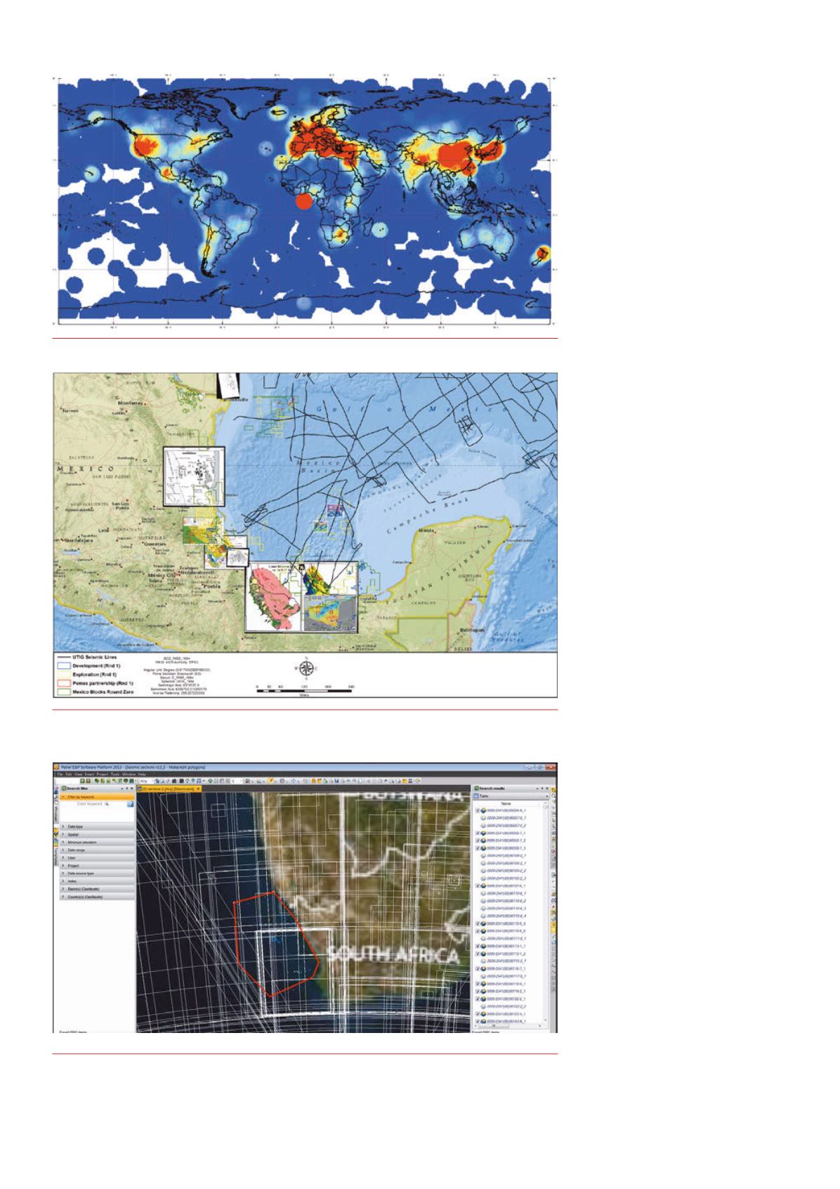
Figure 1.
Heatmap showinggeographic coverage of Geofacets’ content.
Figure 2.
Map showingGeofacets’ maps integrated into ArcGIS project in theGulf of Mexico, a region of
increasing interest since the implementation of energy reform inMexico over the last year.
Figure 3.
Geofacetsmap results showing over 8000 initial results. White outlines are themap outlines or
‘footprints’. Map results are listed in the right pane in the SearchResults Table.


